 This article is part of a series dedicated to Dr. David Livingston, in recognition of his accomplishments in defending the reliability and inerrancy of the Bible, and in celebration of the 40th anniversary of his founding of the ABR ministry. This article is Dr. Livingston's groundbreaking work on challenging the scholarly consensus pertaining to the location of Bethel and Ai.
For over a century most scholars have been agreed that the village of Beitin, north of Jerusalem, is the site of biblical Bethel. A large quantity of literature has been published based on this assumption. W.F. Albright and James L. Kelso have excavated there intermittently through the years, beginning in the 1930's. The result is that it has become (probably) unanimously agreed that Beitin is Bethel. Reports of the digs have been published in various journals. But the scholarly world has welcomed the definitive publication of the results recently in The Excavation of Bethel.[1]
With such careful and painstaking work, much of it basic to an understanding of Palestinian archaeology and history, it hardly seems possible that Beitin may not actually be Bethel after all. Nevertheless, that is what we propose.[2]
Before beginning, we do well to remind ourselves of the basic importance of this biblical city, mentioned more often in Scripture than any other site except Jerusalem. Its proper location is absolutely essential. Dr. Albright says, “(Bethel) is regarded by all topographers of competences as one of the cornerstones of ancient Palestinian topography.”[3]
Among important considerations, Bethel was on the border between Israel and Judah. So strategically located was it that Jerboboam built his southern temple there to intercept worshippers traveling to the temple in Jerusalem. Just as important as the events which took place there is the fact that Bethel is the geographical key to locating many other cities in Benjamin and southern Ephraim which are still clouded in uncertainty. Probably the one of chief interest is Ai, which is not yet absolutely identified.
Confusion over an early or late Conquest date may be settled by finding Ai. There is textual evidence for the burning of only three cities by Joshua: Jericho (Josh. 6:24), Ai (Josh. 8:28), and Hazor (Josh 11:13). (This seems to have been ignored by archaeologists ready to date the conquest by destruction levels found all over Palestine.) Hazor has evidence for both early and late dates.[4] Kathleen Kenyon’s excavations at Jericho are indecisive respecting the Conquest, while John Garstang, on the basis of his own findings, held out for an early date to his dying day. Thus, a new site for Ai and its excavation may settle once for all a problem vital to Near Eastern comparative chronology.
A final word of introduction is that the burn level at the Beitin excavation can be said to be the key factor in settling on a late date for the Conquest. Joseph Callaway correctly states, “Professor W. F. Albright’s view that the Conquest occurred in the latter part of the thirteenth century B.C. has generally prevailed.”[5] But now, if it can be demonstrated that Beitin is not Bethel, scholars may have a new opportunity to reassess the evidence for the date of the Conquest. The evidences advanced for the identification Bietin=Bethel cover five areas: tradition, archaeology, Bible etymology, and patristic testimony. The last two were utilized with much effect by Edward Robinson in the nineteenth century. (Actually, the first kind of evidence can also be included here inasmuch as the tradition identifying Beitin with Bethel really began with him.) That his conclusions have been generally accepted is evident in what Dr. Albright says:
But no scholar made the obvious identification of Beitîl with Khirbet Beitîn, an hour’s walk northeast of el-Bîreh, until it fell into the lap of the great American Biblical topographer, Edward Robinson, along with many other sound identifications, in May, 1838. He examined the extensive ruins of the ancient city, then entirely unoccupied, and noted that the phonetic relation of Beitîn to Beitîl is entirely normal in Arabic.
Since the publication of Robinson’s results in 1841 no competent topographer has hesitated for a moment to accept the identification as essentially correct….[6]
It is clear from this quotation that Robinson made the initial convincing identification. Other have followed his lead.[7]
What were the proofs used for the identification? He writes:
There is little room for question, that both the name and site of Beitîn are identical with those of the ancient Bethel. The latter was a border city between Benjamin and Ephraim; at first assigned to Benjamin, but conquered and afterwards retained by Ephraim. According to Eusebius and Jerome, it lay twelve Roman miles from Jerusalem, on the right or east of the road leading to Sichem or Neapolis (Nậbulus). From Beitîn to el-Bîreh we found the distance to be forty-five minutes, and from Bîreh to Jerusalem three hours, with horses. The correspondence therefore in the situation is very exact; and the name affords decisive confirmation. The Arabic termination în for the Hebrew el, is not an unusual change; we found indeed several instances of it entirely parallel. Yet the name has been preserved solely among the common people. The monks appear for centuries not to have been aware of its existence; and have assigned to Bethel a location much further towards the north. Our friends the Greek priests at Taiyibeh had also recognized the identity of Beitîn and Bethel; and had endeavored to bring into use the Arabic form Beitîl as being nearer to the original; but it had found currency only within the circle of their own influence. From them the missionaries in Jerusalem had heard of the place and had learned the name Beitîl; though from others they had heard only of Beitîn.[8]
Robinson is saying, then that his identification Beitin=Bethel is on two bases. These are the name itself (etymology) and Eusebius’-Jerome’s reference to the distance from Jerusalem (patristic). Another basis of identification maintained presently is the archaeological evidence. Dr. Albright’s best-known evidence is the ca. 1250 B.C. burn level at Beitin, of which he says, “Bethel fell into the hands of the Israelites, who burned it to he ground, somewhere in the thirteenth century.”[9] The archaeological history of Beitin deduced from the excavations since the 1930’s seems to fit into the biblical history of Beitin, provided that the Conquest occurred late.[10]
A major problem in identifying the site on the basis of biblical material is that specific references to direction and distances of neighboring towns are almost non-existent, even though the Bible mentions Bethel often. This makes a biblical study of Bethel’s comparative geographical location very difficult. There is no study related to identifying the site biblically in the recent American Schools publication. The reader is referred to Sternberg’s comprehensive biblical study in 1915. However, there is a survey of the site biblically in chapter ten of The Excavation of Bethel, assuming Beitin is Bethel.
The evidences used in the identification Beitin=Bethel will all be examined later in detail. Before we review them, a major problem should be considered which is more closely related to the identification of Bethel than is generally realized. That is the long-standing problem of locating “Ai.”
One of the greatest problems in the identity Beitin=Bethel should be that of the uncertainty surrounding the location of Ai. Because of this uncertainty, a number of theories have been advanced concerning the Bethel-Ai locations. W.F. Albright suggested that Ai was mistaken for Bethel by the Bible writers.[11] It has been proposed that Ai was only an insignificant outpost of wooden structures, none of which remain.[12] Others have said that Bethel is near Shechem.[13] As a result of his excavations, Joseph Callaway’s conclusion is that et-Tell was Ai, but that the Conquest was in Iron I (12th century B.C.),[14] later than most scholars accept. Grintz has suggested that et-Tell is actually Beth-Aven[15] Noth and others dismiss the whole biblical account as unhistorical and therefore unreliable, little more than aetiology.[16]
Callaway well says of the et-Tell=Ai equation, “Ai is simply an embarrassment to every view of that Conquest that takes the biblical archaeological evidence seriously.”[17]
The traditional location for Ai given by Eusebius and Jerome is also indefinite:
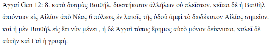
Jerome: Aggai ad occidentalem plagem uergit Bethelis, nono multum ab ea distans. Sita est autem Bethel euntibus Aeliam de Neapoli in laeua parte uiae duodecimo circiter miliario ab Aelia, et usque hodie, paruus licet uicus, ostenditur. Sed et ecclesia aedificata est ubi dormiuit Iacob pergens Mesopotamiam, under et ipsi loco Bethel, id est domus dei nomen imposuit. Aggai uero uix paruae ruinae resdent, et locus tantummodo demonstrator. Et sciendum quod in Hebraeo G litturam non habet, sed uocatur Ai, scribiturque per elementum quod apud eos dicitur Ain (5, 26).[18]
As one can see from these citations, and as Conder points out, Ai was unknown in the fourth century.[19] We will not, therefore, learn much from Eusebius and Jerome that is factual. A study of the accounts of the Palestinian surveyors of the last century,[20] Robinson, Conder, Thomsen, McGarvey, Ritter, etc., indicates that Ritter summed up the situation well for his day in saying, “There is now no uniformity among travelers in their judgments respecting the location of Ai.”[21] But, since their time, even with archaeological research, there is little more certainty today. One of the few people who seem to be certain that et-Tell is Ai is W.F. Albright, this originally as a result of Mme. Marquette-Krause’s early excavations.[22]
Biblical prerequisites for the location of Ai are several. We shall group them geographically and topographically. Geographically, Ai must be located east of Bethel and not far away. They are “twin cities”[23] (Josh. 12:9). Secondly, Beth-Aven is “beside” Ai and east of Bethel (Josh 7:2).[24] Thus, one concludes Beth-Aven must also be east of Ai. Next, Michmash should be east of Beth-Aven (I Sam. 13:5). Finally, the size of Ai is important. Gibeon was greater than Ai (Josh. 10:2). In fact, Ai must have been unusually small for a Canaanite city since only 3,000 men were thought necessary to take it (Josh. 7:3).
Topographically speaking,[25] there must be a definite hill (Heb.-“har”) between Bethel and Ai (Gen. 12:8). This hill would be west of Ai. Secondly, there must be a valley (Heb.-“emeq”or “gay”) on the north of Ai with a hill (evidently) beyond it (Josh. 8:10 f.).[26] There also seems to be a plain (Heb.-“arabah”) nearby. Finally, there must be a descent (Heb.-“morad”) not far away going down to Jericho (Josh. 7:5).[27]
What shall we conclude then, as to et-Tell’s being identified with Ai? J. Simons gives four reasons why et-Tell cannot be Ai: 1. It is not near Bethel; it is approximately 2 miles away. 2. It was not inhabited during the Conquest (by any reasonable reckoning). 3. It is too large (larger than Gibeon, instead of smaller). 4. There is no broad valley to the north.[28]
We feel that Simon’s reasons numbered two and three are valid. On the other hand, number four is not really correct. There is a valley to the north. The first reason may or may not be correct, depending on the meaning of Hebrew “ ‘im.” However, as one walks over the area between Beitin and et-Tell, he hardly has the impression that they were “twin cities,” because of the considerable distance and open space between. But, in addition to Simon’s valid reasons, et-Tell is wrongly located in relation to Michmash. It is north of Michmash when it should be west. Furthermore, there is only a small hill, instead of a mountain, west of et-Tell, and this hardly fits the biblical description. Probably the most important of these reasons is the fact that et-Tell could not have been inhabited during the Conquest by whatever date it is calculated.
In light of the uncertainty about Ai, the lack of evidence that et-Tell fits the biblical description, and the apparent reasons et-Tell is not Ai, we feel justified in concluding that Ai has not yet been discovered. And since the location of Ai depends upon the location of Bethel, it may be time to raise the obvious question: Is Beitin really Bethel?
The common, now traditional, identification of Beitin with Bethel is comparatively recent. Important to note is the long gap in the tradition identifying Bethel. Ritter sums up the history of the identification well in saying:
Notwithstanding that the site of the once so renowned Bethel…on the primitive boundary of Ephraim and Benjamin (Josh. xviii. 13, xvi. 1,2), was completely unknown at the beginning of the present century, yet there is no doubt concerning the identity of Bethel with the modern Beitin.
At the time of Eusebius and Jerome it was only an important place, whose situation fell into entire oblivion at the time of the Crusades…. In the centuries after the holy wars, the site of ancient Bethel was sought elsewhere, in the neighbourhood of Shechem; and even in Robinson’s time the monks of Jerusalem did not suspect that Beitin occupied its site.[29]
From this it is plain that the traditional identification of the site does not reveal anything that is certain.
What is considered to be important archaeological evidence is the 1250 B.C. burn level at Beitin, supposedly confirming a conquest by Joshua. However, we must keep in mind that Scripture nowhere, not even in Judges 1, gives warrant for our expecting an Israelite burn level at Bethel. Other (Noth among them)[30] have suggested that this very campaign and burn level could have been caused by the Philistines. Alt says, “Not every destruction which happened to a Canaanite place in the time of the Israelite conquest needs to be the result of the conquest, not every conquest the work of the Israelites.”[31]
When the writer asked Dr. Albright for convincing archaeological proof of Beitin’s being Bethel, his reply was, “I am afraid that the archaeological evidence for Beitin=Bethel would not necessarily be convincing without the Biblical and Patristic evidence.”[32] From this we can come to but one conclusion. There is no clear archaeological evidence that Beitin=Bethel.
The problem with saying that the archaeological history agrees with the biblical history at Beitin is that the reasoning seems to be circular. When one assumes Beitin is Bethel (although there is admittedly no archaeological proof for it), And when one assumes the Conquest is late (as against I Kings 6:1, Judg. 11:26, Acts 13:20), and when one assumes Joshua burnt Bethel (although there is no biblical evidence for it whatever), only then can archaeology be used as “proof” that Beitin is Bethel. Only then does the archaeological history bear out the “biblical” record. Are we justified in using archaeology to identify a site when that site has not been identified by archaeology?
The next evidence to consider is the biblical. Although they are few, some geographical and topographical inferences may be helpful in locating Bethel. The location of Bethel depends as much on Ai as vice-versa. (Bethel is west of Ai—Gen. 12:8, Josh. 7:2, 8:9, 12.) It is “beside Ai” (Josh. 12:9). But if Ai has not been discovered after careful search over a large area, what does that say for the equation Beitin=Bethel?
Bethel must have been a road juncture. It was obviously on the main trade route north and south.[33]It was also a junction for east[34] and west[35]traffic.[36]
What follows from this is that the true Bethel must have the characteristics of a “living town.” That is, because of its location , it almost never ceased to be inhabited; or it did, quickly and naturally revived.[37] In the hill country such towns are Shechem, Bethel, Hebron (and Beersheba in the Negev), the towns Abraham visited. There should be such living towns in each of those places if we have properly identified the location of the ancient towns. (The other three towns are thriving, although tell Beersheba is just outside the modern city). The question naturally arises, why is Beitin a “dead” town today? There is a small community, but no market. It is not on any really main road junction. It was not even occupied in Robinson’s day when the first real identification was proposed![38]
Bethel was a border town between Ephraim and Benjamin.[39] What makes borders? Often geological formations do. Baly points out that among other geological rifts going east and west across Palestine, one “is a line drawn through Lydda (Lod), Ramallan and Amman,”[40] and another is “…the valley of Aijalon leading up to Ramallah.”[41] This natural line of division is at least two miles south of Beitin.[42] The importance of the existence of this abnormal bulge northward in the border (the writer feels) has been overlooked by geographers.
The Bible says there is a mountain (Heb.-“har”) between Bethel and Ai (Gen. 12:8). Yet Ritter says, “Abraham erected a tent in the valley between them” [Bethel and Ai].[43] (Actually there is a small valley between Beitin and et-Tell.)[44] Ritter then cites Genesis 12:8, which plainly says there is a mountain between the two! The writer fails to see the propriety of changing Bible statements to fit actual conditions. It would seem better to point out that the topography does not agree with the biblical description.
Based on the reasons given above, we may conclude that Bethel should be both on the border and a crossroads town situated on a natural geological division north and south (the ridge) and east and west (Aijalon and Suweinit Valleys). We should note that Beitin has been mentioned to be north of the pass (too far north to control it) and, although on an important east-west road, not at the main junction in the area. Finally, it is apparent that the topography does not match the biblical description.
In concluding our consideration of the biblical evidence, we quote Dr. Albright, who says of it:
I don’t think we can say very much about the identification of Bethel with Beitin from Biblical sources. The references to Bethel make its general location clear; it must have been very near Beitin but none of them gives a specific reference except in connection with neighboring towns on the border between Judah and Israel or near Ai or Beth-Aven, both of whose identifications rest on Bethel=Beitin.[45]
Another important means of identification is that of etymology: Beitin=Beitil=Bethel. This etymology, agreed with by many, may or may not be valid.[46] Even if is valid, we must keep in mind Dr. Albright’s suggestion that names are sometimes transferred:
Nor can we agree entirely with the Alt school about the tenacity with which names and traditions adhere to sites. It is quite true that names are much less mobile than shifts (e.g., “Syria”) and names of towns and villages are frequently displaced over a considerable local area (e.g., “Jericho”). Traditions connected with places are notoriously shifting.[47]
Long historical gaps exist in our knowledge of Bethel’s location (as much as fourteen hundred years in this era). Thus, Bethel may be another example that the names of cities are sometimes “displaced over a considerable local area.” This Dr. Albright acknowledges, “…some have thought of the possibility that the Israelite town might have stood on a site within a radius of a mile or so from modern Beitin.”[48]
The last kind of evidence to consider is the patristic. In doing so, we should remember that no one is known to have equated Beitin with Bethel until the nineteenth century.[49] Then, once Robinson made the identification, it has generally been accepted as correct.
Although The Excavation of Bethel mentions (in chapter ten) references to Bethel in extra-biblical literature, these are not useful in the identification, being only historical references with no definite geographic “locaters.” The patristic evidences used (in chapter one) are the same ones Robinson used: Eusebius’ Onomasticon and Jerome’s Hieronymous (along with the fourth century Itinerarium Burdigalense). Eusebius and Jerome are almost exactly the same, the former being in Greek, the latter in Latin. Jerome, living later, has corrected and amplified Eusebius in a few places. Before we use these sources, we should Robinson’s word of caution, “This little work is of high importance, although the notices do not always rest on historical facts, and are sometimes colored be legendary tradition. Nor are the two writers always in one accord.”[50] But what Robinson says of the fourth-century writers is many more times true of nineteenth-century explorers, who may have erred even worse in identifying sites lost for hundreds of years! Bethel was still well known in the fourth century. But, there is no certain historical mention of it (that we know of) for 1400 years after that time. Surely we should have exercised greater caution in accepting Robinson’s identification of Bethel which does not “rest on historical fact” itself.
What is the evidence from Eusebius-Jerome? Supposedly they say Bethel is 12 Roman miles north of Jerusalem on the road to Neapolis and lies on the east side of the road. The texts are the following:[51]
Eusebius, above. (40,20).[52]
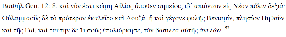
Bethel uicus in duodecimo ab Aelia lapide ad dexteram euntibus Neapolim, quae primum Luza, id est (greek here), uocabatur et cecidit in sortem tribus Benjamin, iuxta Bethaun et Gai, quam expugnauit Iesus, rege illius interfecto. Porro quod quidam putant secundum errorem Graecorum uoluminum Ulammaus antiquitus nuncupatam, uehementer errant. Uerbum quipped Hebraeum et nomen ipsius ciuitatulaie partier miscuerunt, etc. (41, 17).
In examining these texts, one notes that mile-markers are what both men speak of, not simply measures of distance. A few stone mile-markers between Jerusalem and Nablus have been turned up over the years and their inscriptions published. We are not absolutely certain where the mile-markers found to date were situated in the fourth century. But probably they were in the same place then too.[53] Of the markers found between Jerusalem and Beitin, the latest are those of Marcus Aurelius (162 A. D.).[54] There are only three milestones which can be of any help on this problem. They are numbered by Thomsen: 261, 262, 263, the fifth, fourth and third, respectively. Only the fifth has the actual mileage inscription still visible.[55]
Based on the fact that the fifth marker was found at least one mile southwest of er-Ram,[56] one would expect eventually to find a sixth near er-Ram to the south.[57] With such we find Eusebius and Jerome in agreement:
Rama (Josh. 18:25). fulhs Beniamin polij Saoul apo j, shmeiwn <Ailiaj> eij Borra/n apenanti Baiqhl memnhtai authj kai .Iepemiaj (144,14). (footnote: Cart. Med. 30:PAMA)
Rama in tribu Benjamin ciuitas Saulis in sexton miliario ab Aelia ad septentrionalem plagam contra Bethel. Meminit huius et Ieremias (145, 13.)
(footnote: Hier. Comm.. in Hos. 5:8 f.: “Rama…in tribu Benjamin…in septimo lapide a Ierosolymis sita.”)[58]
This brings us to a very important point. Since Rama is slightly more than half-way (5.5 miles)[59] from Jerusalem to Bireh, and between the 6th and 7th miles-markers, the conclusion is that the 12th mile-marker would have been found near or in Bireh, depending on the route taken.
Eusebius-Jerome’s statement concerning 12 miles, if taken only as a measurement of distance from the Damascus Gate of Jerusalem, would bring one to an indefinite place somewhere between Bireh and Beitin.[60] However, even if the Roman road were straighter than the present one, traveling twelve Roman miles still would not take one to Beitin, since the Roman road apparently went through er-Ram (Rama) and the distance would approximate the modern road with its airport by-pass. If the Roman road was longer than the present one built with modern machinery, its greater distance may have required the placing of the twelfth marker in Bireh.
If there seems to be a discrepancy between the measurement of distance and the placing of the milestones, we should then consider another point. That is that the measurement by milestones, instead of beginning at the Damascus Gate, as commonly thought, apparently began well within Jerusalem. Germer-Durand presents telling evidence that the 0 milestone was inside Jerusalem and not at the Damscus Gate.[61] He suggest that the milliarium aureum (golden milestone) may have been at the temple of Jupiter or at the temple of Venus, or even as far south as Nebi Daoud (near the Churh of the Cenacle on Mt. Zion). To substantiate this, he cites the example of the central milliarium aureum of Rome and London, giving their locations. Then, he convincingly demonstrates that measurements from the third milestone found at Shafat put the location of the theoretical first milestone quite close to the Damascus Gate, precluding any possibility that the 0 milestones can be found there.[62]
This fact would add to the distance measured from the Damascus Gate and allow for the fraction of a mile difference needed to put Eusebius-Jerome’s twelfth milestone exactly in modern Bireh.[63] We already saw that the twelfth milestone should have been in Bireh. Now we see that the correct distance also takes one to there. Dr. Albright can hardly be correct when he says, “Beitin lies opposite a point some eleven Roman miles north of Jerusalem.”[64] Under any consideration, Beitin is quite a bit more than 11 Roman miles from Jerusalem. The point is, whether you measure by distance or milestones, neither measurement brings you to Beitin. We feel justified in concluding that the last evidence remaining for identifying Beitin with Bethel (that of Eusebius-Jerome), actually identifies Bethel with another site.
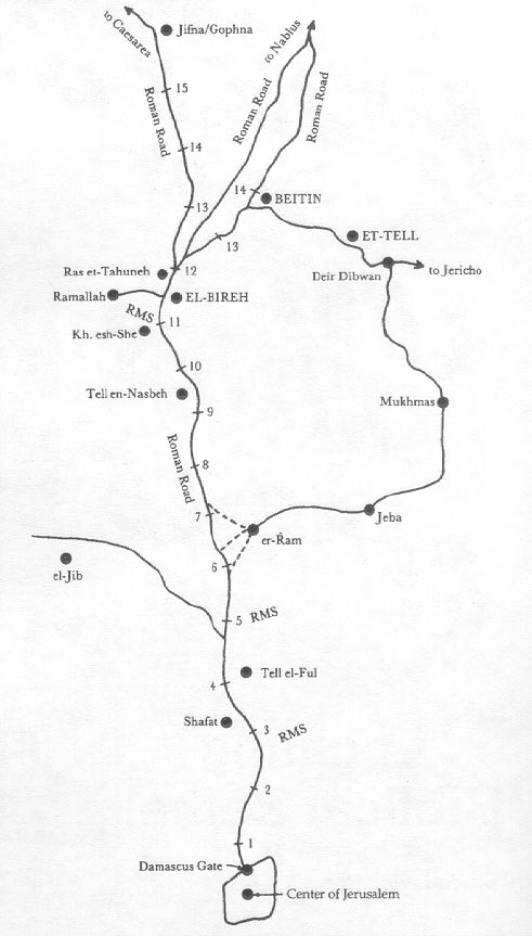
Figure 1. Map traced from The Survey of Western Palestine sheets. 'RMS' indicates Roman milestones which were still in place in 1883.
Having considered the evidence for the identification of Beitin as Bethel and seen that it is wanting, we now propose for the following reasons that Beitin is not Bethel. In doing so, we shall give several reasons not yet mentioned.
Geographical.
1. Roads.
a. Beitin is not on the main crossroad in the area.[65]
b. It is on only one of three Roman roads going from Bireh to Nablus.[66]
c. It was not even on the main northerly Roman road, from Jerusalem to the Roman capital at Caesarea through Gophna, at the time when Eusebius-Jerome would have made their Onomasticon.[67]
d. It is a “dead town” today simply because it is not on main crossroad.
2. Borders.
a. There is an abnormal northerly bend if Beitin is on the border between Benjamin and Ephraim, Judah and Israel.
b. There is no natural topographical feature enabling it to become a border town.
3. Ai has not been discovered east of Beitin.[68]
4. The distance from Jerusalem mentioned by Eusebius-Jerome does not bring one to Beitin.
5. Town names move. Perhaps so in this case. (Nor can certain proof be advanced that Beitin-Bethel etymologically.)
Topographical.
There is a small valley instead of a mountain between Beitin and et-Tell (although there is a small hill just northwest of et-Tell).[69]
Archaeological.
1. The Bible nowhere says Bethel was burned by Joshua.
2. There is no archaeological evidence identifying Beitin as Bethel.[70]
3. Jeroboam’s sanctuary has never been discovered.[71]
4. Chronology of the site accords with high dating.[72]
5. There is no certain evidence Beitin was even occupied in Eusebius-Jerome’s time.[73]
In light of the geographical, topographical and archaeological reasons given above, we suggest that the burden of proof lies on those who wish to continue to hold that Beitin=Bethel.
If Beitin is not Bethel, what city is Bethel? First, we must point out that Bireh is not Beeroth.[74] A traditional identification is that Bireh is the Beeroth of the Old Testament.[75]However, that identification is not acceptable to many scholars. In attempting to identify Bireh, Robinson (who was followed by Ritter and many others) made what appears to be a major misinterpretation of Eusebius in saying:
…according to Eusebius, Beeroth was seen by the traveler in passing from Jerusalem to Nicopolis (Imwus), at the seventh Roman mile. This road was the present camel-path from Jerusalem to Ramleh passing near el-Jib…. The traveler on emerging from the hills into the plains around el-Jib sees el-Bireh on his right after a little more than two hours from Jerusalem.[76]
he text referred to is the following:
Bhrwq (Josh 9:23). upo thn Gabawn kai esti nun kwmh plhsion Ailiaj katiovtwn epi Nikopolin apo z, shmeiwn (48,9).
Beeroth sub colle Gabaon.[77] Ostenditur hodieque uilla ab Aelia euntibus Neapolim in septimo lapide (49, 8). (footnote: “Neapolim” is “Nicopolim” in Vallarsi).
But the only way Robinson could “see” Bireh from the point of which he speaks is at a distance of about three to four miles, for that is the distance of el-Jib from Bireh. It is possible to see Bireh from there since it is so prominent, but that is not what Eusebius meant. He plainly says Beeroth is at the seventh mile-marker, and on the road to Nicopolis. We are not aware that he anywhere else denotes a town’s being several miles away from the mile-marker of which he speaks.[78] The distance Eusebius gives puts Beeroth somewhere between modern Biddu[79] and Nebi Samwil.
It is obvious from both Eusebius and Jerome that Beeroth was on the road to Nicopolis.[80] (not Neapolis), six or seven miles out of Jerusalem. For Robinson to so distort Eusebius-Jerome in his identification of Beeroth,[81] equating it with Bireh, raises more doubt as to the correctness of his identification of other important sites in the tribal area of Benjamin.[82]
We earlier stated that Bireh is 10.3 statute miles (11-12 Roman miles) north of Jerusalem, while Eusebius-Jerome say Beeroth is only six-seven Roman miles out of Jerusalem. This leaves Bireh unidentified for Bireh other than “Beeroth” (which we have seen is impossible)? Yes, but only one within three miles in any direction. What is it?
“BETHEL.”
We suggest a look at the possibility that Bireh[83] is Bethel. Since no excavating has been done, and there has been no archaeological survey of the area undertaken, at this time we cannot use archaeology in making an identification.
The geographical reasons for selecting Bireh as the site of Bethel are numerous. Bireh is a large and growing town (along with Ramallah) and is truly a “living town,” which is what Bethel should be. Perhaps this is because it is the natural crossroads town for the whole area.[84] A look at any map will confirm this. One other feature, important to a Canaanite city, is a good spring. And there is a copious spring in the south part of the town.[85]
Bireh is precisely on the natural east-west geological dividing line, or border. The topography of the area around Ras et-Tahuneh (the highest point in Ramallah-Bireh) is such that it has a horizontal hourglass effect. That is, there is a plain on the north and another on the south. But deep valleys run to the east and west, forcing travelers to pass close by this high point. During the Crusades, Bireh, controlled by the Knights Templar, was called La Grande Mahomerie and was obviously a main fortress and a place of pilgrimage. It seems significant that the Crusaders chose this spot to defend rather than Beitin. It is the place on the Jerusalem-Nablus road to effect a roadblock. The Israelis made good use of this fact in the Six-Day War when they captured this spot early in the fighting. Jeroboam may have also made good use of it in putting a temple there![86]
In considering its placing on the road north out of Jerusalem, it is on the “right side of the road going to Neapolis.”[87] But, even more important, it is the correct number of Roman miles out of Jerusalem. Finally, “Beth-Aven,” in this case, would now be west of Michmash, where it should be, and not north of it (as it is in the case of et-Tell).[88]
The most important topographical reason for this identification is that there is a mountain east of Bireh, instead of a valley. It is called “et-Tawil” (the tall one) and is visible for many miles from any direction, as is (Ramallah-) Bireh also.[89] One can see a good portion of the Jordan Valley from the top of et-Tawil (907 meters above sea level), at whose feet Bireh is situated.[90]
A new location for Bethel also presents a new possibility for the location of Ai. We suggest the small unnamed ruins 1 ½ miles southeast of Bireh. The topography seems correct. Most important is the fact that a large mountain (et-Tawil) lies between Bireh and this ruin.[91] A valley lies just to the north of the small tell, with a hill on the far side. The valley descends into Wadi Suweinit, which in turn goes on down to Jericho.[92] The descent of this valley is steep, easily corresponding to a “morad.”[93]
Archaeologically, the ruin is small, unusually small if it is a Canaanite city. 3,000 men might easily have taken it. Surface pottery on the tell is Roman. But just off the tell and to the north, the surface is covered with early Iron pottery. A spring is on the south side of the tell.
Of course, this can be nothing more than a suggested location. The identification of Ai is primarily linked with correct identification of Bethel.
Concluding remarks:
A new location for Bethel and Ai is an exciting prospect. It has many implications for other city locations in the tribal area of Benjamin. If our new proposal is accepted as correct and excavations are carried on, it may also open some new possibilities for Palestinian dating and better correlations with other Near Eastern chronology. Not the least of these may be some help on the date of the Conquest.
We close this investigation with the words of Melvin Grove Kyle, to whose memory The Excavation of Bethel was dedicated:
The three important requisites of testimony in a court are the place, the person, the time. However important the events narrated, the narrative does not constitute evidence unless the place can be given. If the place can be given, then there is some evidence….It is important carefully to note this order here, for by a reversal of the order and a consequent minimizing of the importance of geography and topography in Biblical discussions and the thrusting of chronology into the first place, the results of archaeological identifications have been belittled and the importance of critical difficulties about petty apparent discrepancies in dates greatly magnified.
Geography is first in importance in history as in evidence in court. No progress whatever toward intelligence in the study of history can be made until we have some answer to the question “Where?” and the better the answer the greater the progress. The most interesting and even startling story of events is no more to us than a legend until we can in some way locate it, can fit it into place in the world’s history. So with the identification of the places in the Bible history; instead of being shoved aside, as of the first importance, without some more or less definite idea of which, nothing else is important at all. [94]
 Dr. Livingston conducted excavations at Khirbet Nisya from 1979-2002. He has identified Khirbet Nisya as Joshua's Ai, based partly on the groundbreaking research found in this article. His book on PDF CDs, Khirbet Nisya - The Search for Biblical Ai, 1979-2002, can be purchased in the ABR bookstore.
This article was first published in the Westminster Theological Journal, 33.1, November 1970, pgs. 20-44. Posted with permission.
Endnotes:
[1] Annual of the American School of Oriental Research, 39, (edited by James L. Kelso, Cambridge, 1968). Hereafter referred to as Bethel.
[2] The writer became interested in this problem while studying at the American Institute of Holy Land Studies in Jerusalem in 1966. He is indebted to the faculty and staff for the unsparing help received in January, 1969, while he was researching in the area north of Jerusalem.
[4] For early date evidence in area K, see The Biblical Archaeologist (hereafter BA), 22, 1 (1959), 8 f.
[5] Journal of Biblical Literature, 87, 3 (Sept., 1968), 313. Dr. Albright’s own conclusions were arrived at in 1934, as seen in the following: “Somewhere in the thirteenth century B.C. the second phase of [the] Late Bronze [city] was destroyed by a tremendous conflagration,…We have never seen indications of a more destructive conflagration in any Palestinian excavation. The break between this and the following stratum is also more complete than in any other case except between Iron II and Hellenistic…the break becomes so much greater that no bridge can be thrown across it, and we are compelled to identify it with the Israelite conquest. In reaching this obvious and inescapable conclusion, the writer abandons a position which he has held for eleven years, and adopts the low date of the Israelite conquest of central Palestine. In connection with this change of position, he also abandons Garstang’s view of the date of the Israelite capture of Jericho,…” (italics ours) Bulletin for the American Schools of Oriental Research (hereafter BASOR), 56 (December, 1934), 9-10. “…the burden of proof is now entirely on those scholars who still wish to place the main phase of the Israelite conquest of Palestine before the thirteenth century B.C. The views of Professor Garstang, Sir Charles Marston and others are devoid of concrete archaeological foundation.” BASOR, 74 (April, 1939), 23.
[7] Carl Ritter, in his monumental four-volume work, followed Robinson in saying, “…as far as to about the end of the fifteenth [nineteenth?] century, [Robinson’s] is one of the most complete and critically perfect that we possess.” The Comparative Geography of Palestine and the Sinaitic Peninsula, I (tr. William Gage, New York, 1866), 22.
[8] Biblical Researches in Palestine, I (Boston: Crocker and Brewster, 1856), 449-50. (Hereafter cited as Researches.) John Wilson, The Lands of the Bible (Edinburgh, 1847), p. 287, also quotes and follows Robinson.
[9] BASOR, 56 (Dec., 1934), 11; cf. also: BASOR, 74 (Apr., 1939), 17; Bethel, p. 48.
[10] See chapter ten of Bethel for a detailed comparison of the archaeological and biblical history.
[11] BASOR, 74 (April, 1939), 16-17; BASOR, 56 (Dec., 1934), 11, But Bethel was a hallowed and well-known center for centuries in Israel. How could it be confused with Ai? Furthermore, the tribe of Joseph attacked and conquered Bethel while Ai was still a “heap of ruins” (Judg. 1:22-26).
[12] E.g., see G.E. Owen, Archaeology and the Bible (Westwood, N.J., 1961), p. 321.
[13] C.R. Conder, Tent Work in Palestine, II (London, 1879), 106-7. (Hereafter cited as Tent Work.) He speaks of a “heretical Bethel”. Cf. also W. Ross, “Is Beitin the Bethel of Jeroboam?,” Palestine Exploration Quarterly, 1941, 22f.; also , Ritter, Geography, IV, 227.
[14] Joseph A. Callaway, “New Evidence on the Conquest of Ai,” JBL, 87 (Sept., 1968), 316.
[15] J.M. Grintz, Biblica, 42 (1961), 201 f.
[16] Albright, BASOR, 74 (Apr., 1939), 16. G.E. Wright, Biblical Archaeology (abridged edition; Philadelphia, 1960), p. 48.
[17] Callaway, op. cit., p. 312.
[18] Eusebius, Onomasticon (ed. Klosterman, Leipzig, 1904). All references hereafter to this third and fourth century work of Eusebius-Jerome are from this title. The number sin parenthesis indicate the page and line at which the citation begins.
[19] Conder, Tent Work II, 108.
[20] Early geographers, in taking biblical descriptions and seeking to locate Ai, concluded that it could Deir Dibwan, et-Tell, Taiyebah, Haiyan and other places. All this led Robinson to conclude that no one could be sure where Ai was.
[21] Ritter, Geography, IV, 223, note 4. Cf. also Robinson, Researches, I, 443.
[22] BASOR, 74 (Apr., 1939), 15, “…et-Tell which unquestionably represents biblical Ai…”; and p. 17; cf. also BASOR, 56 (Dec., 1934), 3 for earlier, but similar conclusions. For confirmation that Albright still hold this view, see Bethel, p. 2.
Callway in his lecture at Wheaton College in 1966 (reported to the writer by Dr. Gleason L. Archer, Jr., Trinity Evangelial Divinity School) suggested that Albright had swung scholarly opinion in equating et-Tell with Ai. In his recent article he says, “The Iron Age I village at et-Tell is therefore a regionally sealed locus. There is no Late Bronze evidence in the region east of Bethel that I can find. This, incidentally, confirms Albright’s conclusion ‘…that there is no other possible site for Ai than et-Tell,’ a conclusion based upon his personal surface exploration of the district east of Bethel” (Callaway, op. cit., p. 315).
[23] So says Albright in The Annual of the American Schools of Oriental Research (hereafter AASOR), IV (1924), 143. He says they must be close together.
[24] Brown, Driver, Briggs, Hebrew and English Lexicon, p. 110, says Beth-Aven is “eastward from Bethel.”
[25] Robinson gives an excellent summary of the biblical topography in Biblical Researches, I, 574.
[26] In Joshua 8:18, Joshua stretched out his hand and spear while standing somewhere north of Ai, and the ambush west of the city was able to see him.
[27] Conder described the valley running down to Jericho, “…about 2 miles S.E. of Ai (in this case Haiyan) it becomes a narrow gorge with vertical precipices some 800 feet high—a great crack or fissure in the country…,” Tent Work, II, 110.
[28] J. Simons, American Journal of Archaeology, 51 (July-Sept., 1947), 311. See also J. Simons, The Geographical and Topographical Texts of the Old Testament (Leiden, 1959), p. 270.
[29] Geography, IV, 226-227 (italics ours). ‘…it is only within the last three or four years that its name and site have been discovered among the common people, by the Protestant missionaries in Jerusalem” (Robinson, Researches, I, 451). Cf. also O. W. McGarvey, Lands of the Bible (Philadelphia, 1880), p. 239. For other history and bibliography, see Ritter, Geography, I, 22-23, and Robinson, Physical Geography, pp. 6-11.
[30] See Edwin Yamauchi’s article in Christianity Today, 10, 4 [Nov. 19, 1965], 6.
[31] Cited by J. Alberto Soggin, “Ancient Biblical Traditions and Modern Archaeological Discoveries,” BA 23, 3 (1960), 98.
[32] Letter of January 30, 1968. (Permission to quote granted in letter of January 12, 1970.)
[33] On P. Thomsen’s (“Die römischen Meilensteine der Provinzen Syrian, Arabia und Palestina,” Zeitschrift des deutschen Palästina-Vereins (hereafter ZDPV), 40 (1917), 1-103 and Michael Avi-Yonah’s (Map of Roman Palestine, London, 1940) maps we call attention to the fact that the main road from Jerusalem to Caesarea, the capital during Roman times, bypasses Beitin on its way through Gophna. This is very clear also in Avi-Yonah’s The Holy Land (Grand Rapids, 1966), p. 182. Abel points out also that Beitin was on only a branch of the main northerly road: “De Naplouse l’artère central se dirigeait sur Jérusalem par Huwāra, ‘Ain Berqīt, Lubbān, Kefr ‘Ana, Gophna, el-Bīre, Tell el-Fūl; route Bậtie sous Nerva où l’on a relevé les milliares 1, 2-5, 18, 25 a partir d’Aelia. Brance sur Béthel de Kefr ‘Ana à Bīré.” Geographie de la Palestine, II (2nd ed.; Paris, 1938), 226. Cf. also George Adam Smith, The Historical Geography of the Holy Land (New York, 1897), pp. 250-251 and Yohanan Aharoni, The Land of the Bible (tr. Anson Rainey, London, 1966), p. 56.
[34] From the Jordan valley to Bethel and north. Cf. II Kings 2:2 ff., 2:8 ff.
[35] From the sea coast up to Bethel and then along the ridge road. Through Aijalon goes “the most important of all the routes up into Judea from the plain….Through it an easy road goes up past the two towns of Beth-Horon…and on reaching the highlands [at Ramallah-Bireh] it divides, giving access to either Bethel [Beitin] or Jerusalem” (Dennis Baly, The Geography of the Bible (New York, 1957), p. 145, also pp. 4 and 36). Cf. Josh. 10:6-14. See also G.A. Smith, Historical Geography , p. 250.
[36] “Every city mentioned in the Abraham story was a key caravan city…. Bethel, on the same ridge road [as Shechem], was also a junction point for east-west traffic. This road came from the Mediterranean up the valley of Aijalon to Bethel and then descended to Jericho, where it crossed to Transjordan and Arabia.” James Kelso in Christianity Today, 12, 19 [June 21, 1968], 6. Among the “crossroads” towns Baly mentions is Bethel, Geography, p. 117.
Joshua’s purpose in taking Ai may have been to gain control of this crossroads before going north to Shechem. G. A. Smith probably rightly suggests that the Philistine’s basic purpose in the highlands was to control these trade routes (Historical Geography, pp. 250 f.). For later times and more confirmation, see Avi-Yonah’s The Holy Land. He has made a creful study of intertestamental and Roman roads.
[37] W. F. Albright (Yahweh and the Gods of Canaan (Garden City, 1968), p. 63) says that a great deal of trading was going on then.
[38] “A few Arabs, probably from some neighbouring village, had pitched their tents here for the summer…and they were the only inhabitants” (Robinson, Researches, I 449).
[39] Josh. 16:1, 2; 18:12, 13. Jeroboam’s temple was built at Bethel to intercept travelers to Jerusalem—I Kings 12:29. Aharoni, Land, p. 283, suggests that temples were placed on borders in other areas also, citing the recently found temple at Arad.
[40] Baly, Geography, p. 27.
[41] Ibid., p. 28; cf. p. 36. The early geographers say something of this natural division. G. A. Smith (Historical Geography, p. 248) states, “…the natural boundary will be the vale of Aijalon, which penetrates the Central Range, and a line from it across the water-parting (divide) to the Wady Suweinit, the deep gorge of Michmash which will continue the boundary to the Jordan at Jericho.” Cf. Conder, Tent Work, II, 110; Ritter, Geography, IV, 221.
[42] In considering the town lists of Exra 2:20 ff., and Neh. 7:25 ff., G. A. Smith says, … “these are either upon or south of the line from Michmash to Aijalon, except Bethel (Beitin) which is a little to the north” (Ibid., p. 252).
[43] Ritter, Geography, IV, 223.
[44] Dr. Albright describes this feature in saying, “The spur on which Bethel was located is separated from the higher ridge to the east by the Wậd et-Tahûneh…” (Bethel, p. 2).
[45] From a postcard of February 16, 1968. (Permission to quote granted in letter of January 12, 1970.)
[46] The writer, during a recent trip to Israel asked an Arab what “Beitin” (written in Arabic) meant. The prompt answer was, “Two houses” (dual form). Aharoni, Land, p. 98 gives examples of cities named after buildings or fortifications (Dor, Succoth, Kir, Hazor, Migdal, Shimron, etc.). In considering etymology, it does seem intriguing that there were precisely two ruined buildings prominent when the site was resettled about 100 years ago, after having been abandoned for a considerable time. Robinson mentions them in Researches, I, 449. They are a tower and a church. Others mentioning them are: Ritter, Geography, IV, 226; Wilson, Lands, p. 287; McGarvey, Lands, p. 239. W. M. Thomsen, The Land of the Book (New York, 1882), p. 92. Evidently, these were the most prominent landmarks among the ruins. Is it possible that the community, resettled by natives of Burqah within the last century, may simply have received its name from these two ruined buildings, rather than from the etymology of Beitin=Bethel? Another interesting etymological note is that Conder (for some reason, perhaps worthy of more careful study) equates Hebrew “Bethaven” with Arabic “Beitin” (Tent Work, II, Appendix A, 335).
[47] BASOR, 74 (Apr., 1939), 14. Cf. also Paul Romanoff, Onomasticon of Palestine (Philadelphia, 1937), p. 162, and Aharoni, Land, p. 112.
[49] Dr. Albright mentions this is Bethel, p. 1.
[50] Robinson, Physical Geography, p. 8. Ritter sounds the same note of caution, “[it is] necessary to use the Onomasticon with a certain degree of caution, which is heightened by the fact that, at the period when Eusebius and Jerome lived, many of the localities mentioned in the Old Testament had long been forgotten, and their site was merely conjectural, or assigned by the voice of tradition, to which these good fathers too easily assented. Their accounts, where they do not palpably harmonize with Scripture narrative are to be subjected therefore to careful investigation” (Geography, I, 31).
[51] Other texts are mentioned in Bethel (p.3), but these are the crucial ones.
[52] Noted references are Gen. 28:19; Josh. 18:13, 22; 7:2; 12:16; Judg. 1:23.
[53] See Charles Clermont Ganneau’s Archaeological Researches in Palestine II (London, 1873-4), 295-297, 442 ff. for groups of mile-markers found in a number of places.
[54] P. Thomsen, ZDPV, 40, 75-77.
[55] That marker is number 261. It is found in Corpus Inscriptionum Latinarum, III, 117=6649=12088. The important section (for our purpose) of mile-marker #261 from Thomsen says:
[MP V von Aelia Capitolina] Südwestlich von er-Ram:
(Marchus Aurelius 161-180)
“…abnepotes Col(onia) Ael(ia) Capit(olina) m(ilia) p(assum) V. [àπò] Koλ wniaj Ailiaj Kapitwl (inaj) mil (ia) E.”
In examining Conder’s survey map for this period, one notes an “R.M.S.” (Roman Mile Stone) about one mile southwest of er-Ram, which accords with Thomsen’s description. Conder is apparently speaking of this same stone in C.R. Conder and H.H. Kitchener, The Survey of Western Philistine, III (London, 1883), 55. But when he transcribed the inscription, he prefaced each emperor’s name with “IMP” instead of the usual “DIVI” of the CIL inscription. This was before Germer Durand reported on the upper section of the stone found later and appearing in Cosmos, Revue de Science, 169 (Avril 21, 1888).
At Esh-She, south of Bireh, an alleged X milestone is mentioned by Avi-Yonah, Map of Roman Palestine, P. 44. In correspondence with him, he answered (in letter of June 6, 1970), “…we were unable to discover the origin of the reference [in the archives of the Rockefeller Museum]…. The milestone has probably been assigned to the tenth mile from Jerusalem because of its situation , because if it had an inscription it would have been published, then or later.” We want to suggest that this milestone, in line with the point of this article, may actually be the eleventh.
[56] There seems to be a little question among scholars that er-Ram is biblical Rama and the Rama of Eusebius-Jerome.
[57] To our knowledge, no sixth marker has yet been discovered. On Avi-Yonah’s map included with his book. Map of Roman Palestine, he has printed the fifth mile-marker (designated with a “V”) too far south and has included a sixth marker south of Rama. But in the text of the book itself, he makes no mention of a sixth (on p. 44). This may be an error since P. Thomsen and others make no mention of it either and we have not been able to find it published anywhere.
[58] Note that Jerome in his commentary on Hosea says Rama is at the seventh Roman milestone! This may indicate that Rama lay somewhere between the sixth and seventh stones. Conder considers this fact in the Survey, III, 13. Cunningham Geikie, The Holy Land and the Bible, II (New York, 1888), 170, says he saw two Roman milestones “still in position” before getting to er-ram from Jerusalem, but he does not indicate their exact position.
[59] Josephus (Antiquities, VIII, 12.3) says Rama is 40 stadia from Jerusalem—about 5.3 miles. Although he is quite accurate in this case, he seems considerably off in the case of Gibeah and Gabaoth Saul (Gibeah?), 20 stadia and 30 stadia from Jerusalem respectively (Antiq., V, 2.8; Wars, V, 2.1). Although he mentions Bethel several times, unfortunately he never gives the distance. Aharoni, Land, p. 282, says Rama is 5 ½ miles from Jerusalem.
[60] It is slightly more than 10 statute miles from Jerusalem’s Damascus Gate to Bireh, and over 12 miles to Beitin on the modern road. Since one Roman mile equals 1618 yards, compared to an English mile of 1760 yards, 11 modern miles would equal approximately 12 Roman miles.
[61] Germer-Durand, “Une Borne Milliare de Jerusalem,” Recueil d’Archaeologie Orientale, 1888, pp. 280-284.
[62] R. Vincent (Revue Biblique, 1901, pp. 96-100) deals with the same section of road and measurements (apparently measuring by foot!). But, he too discovered (p. 100) that the first milestone cannot possibly be a mile away from the Damascus Gate. Thus, the 0 milestone, of necessity, must be somewhere within Jerusalem.
[63] Thomsen’s milepost #267 supposedly reads in Greek “II’” or 13th mile, and was found near Jifna. However, in a study of the 18th milepost at Yabroud (#260), Clermont-Ganneau points out that Jifna (Gophna) was listed as being at the 15th or 16th milestone (Recueil d’ Archaeologie Orientale, 8 (1907), 93). We suggest, on this basis, that the reading, instead of “II’” (13) should “IE” (15). This accords with Eusebius’ distance and is much more in accord with road distances. Significantly, it further confirms Bireh’s being at the 12th marker.
[64] Bethel, p. 3. Dr. Albright (AASOR, IV, 100) says, “[Ras et-Tahuneh] the ridge on which Ramallah and Bireh are situated, which is nine Roman miles north of Jerusalem in a straight line…” (actually 10.3 statute miles by modern road or 11.4 Roman miles). On page 109 he says, “…from Jerusalem to Tell en-Nasbeh is seven Roman miles in a straight line, a little more by road” (actually more than 9 Roman miles; our italics). We wonder whether distances can be measured in a straight line from town to town and be accurate?
[65] It was on a junction of the road from Jericho joining with the eastern fork of the road from Jerusalem to Nablus. The Jerusalem road forks at Bireh, the western fork going through Gophna (Jifna) to the sea.
[66] See Conder’s Survey map or Avi-Yonah’s Map of Roman Palestine, p. 44 and map.
[67] See note 33. Avi-Yonah (Holy Land, p. 182) says, “By an anomalous arrangement the civil headquarters of the newly-created ‘Provincia Judaea’ were not transferred to the garrison camp, but left at Caesarea, the seat of the former procurator of Judaea. A direct road linking the administrative and military headquarters of the province would naturally be required in these circumstances. The shortest line between Caesarea and Jerusalem passes Antipatris, Thimna and Gophna.”
[68] This includes the most recent surveys of all possible cites in 1969.
[69] A low ridge with no distinct peak lies northeast of Beitin. With some stretch of imagination, one could say it lies “between” the two cities. But et-Tell lies to the southeast of Beitin and the ridge is not actually between them at all. Furthermore, James Kelso (Christianity Today, 12, 19 [June 21, 1968], 8) says, there was a Canaanite sanctuary there in Abraham’s time, which seems incongruous with the erection of an altar to Jehovah in the same place. The importance of this fact could not be any more forcibly pointed out than Yehezkel Kaufman has done in The Religion of Israel (Chicago, 1960), pp. 257-259!
[70] Only strata supposedly correlating with biblical events are presented as evidence. No inscription of any kind identifying the site has been found.
[71] This is the case even though from the earliest to the latest excavations (by Kelso), that was the constant objective of the digs. For instance, see BA, 19, 2 (1956), 41. This is a significant “argument from silence.”
[72] The Bethel chronology (p.xiv) reveals no occupation for 1500-1400 B.C. and 2200-2000 B.C. Both of these dates correspond with important high dates, the former to the Conquest, the latter to Abraham’s and possibly Jacob’s visits to Bethel. In other words, at the two most important times when there should have been occupation for the high (biblical) dates, there was none. Thus, it is possible for those holding to high dates to look for another site.
[73] One cannot be sure a city was there then. All the author of The Excavation of Bethel says of the site is, “…few significant buildings have been preserved, for the peasants have dug deeply in planting their orchards, but a vast amount of pottery is to be found everywhere. It covers all phases of the Roman period” (p. 53). This is a long period. The point is, if it was unoccupied during their day, Eusebius-Jerome could not speak of it.
[74] “The difficulty with the equation Tell en-Nasbeh (or, we could add Bireh) with Beeroth is that Beeroth is never in the Old Testament connected with the road from Jerusalem to Bethel,” so says Chester C. Mccown (Tell en-Nasbeh (New Haven, 1947), p. 38).
[75] For instance, see Young’s Analytical Concordance under “Beeroth”; International Standard Bible Encyclopedia, “Beeroth”; Hasting’s Dictionary of the Bible, “Beeroth,” etc.
[77] Robinson, (ibid.) feels “sub colle Gabaon” means “under” in the sense of “belonged to” inasmuch as Jerome translated the same phrase “hupo tein Gabaon” as “sub colle,” but in another place “vicus ad civitaterm pertinens Gabaon.” We feel he is correct, which only serves to indicate that Beeroth was in the Gibeonite confederation and much closer to Gibeon than Bireh is.
[78] Of Eusebius’ accuracy, Dr. Albright says, “If it were on a Roman road, Eusebius would doubtless have furnished us with an exact statement of proximity…” (AASOR, IV, 98).
[79] Gustav Dalman equated Beeroth with modern Biddu in “Die Nordstrasse Jerusalems” (Palästinajahrbuch des deutschen EvangelischenInstitus (hereafter PJB), 21 (1925), 78 ff.). Some present day Israeli geographers equate it with Khirbet el-Burj, four kilometers east of Biddu. However, Biddu is the correct distance, and on a road going toward Imwus.
[80] So says Buhl (Geographie, p. 173) cited in Albright’s AASOR, IV article on page 104. Avi-Yonah (Holy Land, p. 115) points out that Emmaus became “Nicopolis” in 220 A.D. Today it is Imwus in the Valley of Aijalon. Concerning Beeroth itself, Aharoni (Lands, pp. 194, 301, 362) rightly points out that it was one of four Gibeonite towns, and suggests it may be Nebi Samwil (or near it). It is listed as being near Kiryat-Yearim (Josh. 9:17), which west of Jerusalem.
[81] See W.M. Thomsen (The Land and the Book, p. 86) who makes the same mistake.
[82] Perhaps more credence should be given to the accuracy of Eusebius-Jerome than has been done heretofore.
[83] The Hebrew word “birah” means “castle, or fortified place, palace” and is described as a “late word” by Brown, Driver, Briggs (Hebrew and English Lexicon, p. 108). See the excellent study on this word by Arthur Penrhyn Stanley in Sinai and Palestine (London, 1877), pp. 524-525. Dr. Albright very significantly points out, “The name ‘Luz’ (the former name of Bethel)…means ‘hiding place, fastness, stronghold,’…’ (The Biblical Period from Abraham to Ezra (New York, 1963), pp. 29 ff.).
[84] W.M. Thomsen (The Land, pp. 85-86) said, “…el-Bireh is now, and always has been, I suppose, the limit of the first day’s journey of pilgrim caravans northward from Jerusalem….” Tradition says this is where Jesus’ parents discovered Him missing.
[85] Dalman (PJB, 21, on his map opposite p. 64) calls the wadi just to the south of Bireh, “Wadi el-‘ēn.” McGarvey (Lands, pp. 238-239) says, “A very copious spring at the southwestern corner of the village where the road going north first strikes it, furnishes and abundance of water for all purposes….A short distance below the spring is a large reservoir of fine masonry, now disused and nearly filled with mud.” Ritter (Geography, IV, 228) also mentions it.
[86] Thus, we suggest “Ras et-Tahuneh” is the most likely place for Jeroboam’s temple.
[87] This can be seen on Conder’s map published with the Survey at the time when Bireh was still a small village. Robinson also makes this plain (Researches, I, 575).
[88] Dr. Albright at one time equated Burqah with Beth-Aven (AASOR, IV, 144-5).
[89] See Ritter, Geography, IV, 228; Robinson, Researches, I, 451.
[91] This mountain, lying north and south, is rather unique in that it curves gradually southeastward and drops at an even rate in such a manner that many hundreds of men could lie just behind its ridge out of sight of both Bireh and the ruin and none of them be more than 300 yards from the tell. They could actually be between the two cities, but seen in neither because of this curve.
[92] W.M. Thomsen (Land, pp. 94 ff.) described this section of the wadi past the Sheikh’s tomb as “Wadi el Aye”!
[93] About a mile below, the gorge suddenly narrows to nothing more than a split in the rocks, with sheer cliffs on either side. Could this be the “breakers” (shebarim) of Josh. 7:5?
[94] The Deciding Voice of the Monuments in Biblical Criticism (Oberlin, 1912), pp. 187-188 (our italics).